Texas is no stranger to extreme weather, but it’s been a year. Massive wildfires, intense thunderstorms, widespread flooding, tornadoes and a tropical storm have swept the state.
And the year’s only halfway over.
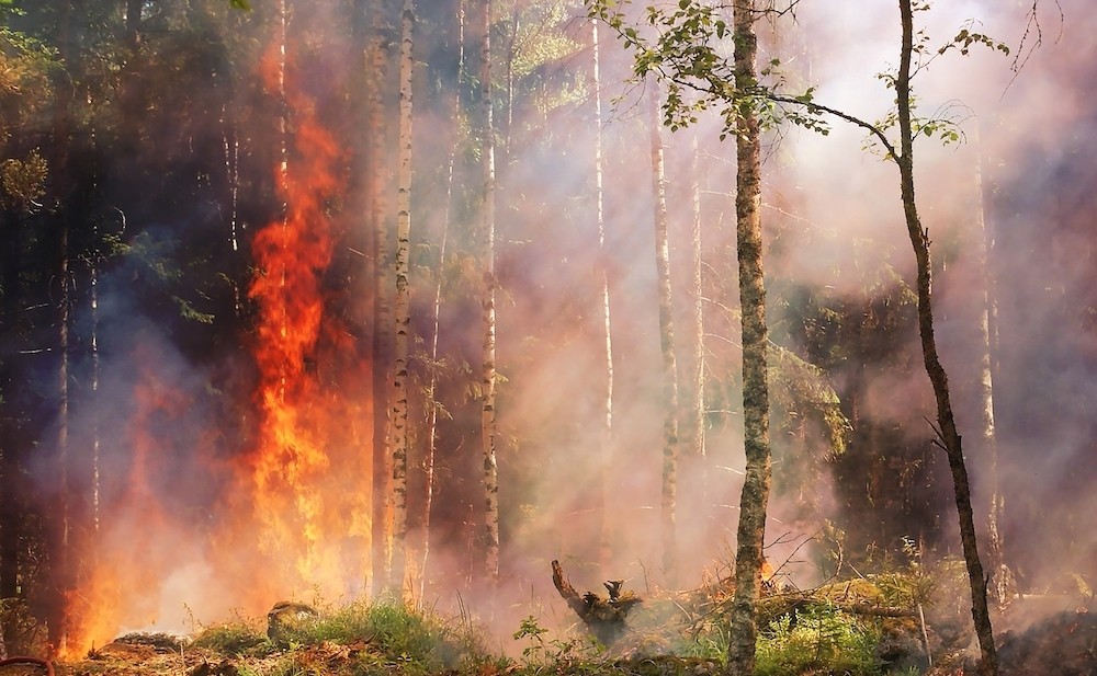
In February and March, the largest wildfire in Texas history burned through more than 1 million acres, killing livestock, destroying crops and gutting infrastructure in the Panhandle northeast of Amarillo. In early May, back-to-back storms drenched Southeast Texas, swelling rivers and creeks and flooding nearby communities.
Later that month, tornadoes struck parts of North Texas and a powerful windstorm known as a derecho slammed the Houston region with 100-mile-per-hour winds, causing widespread blackouts and property damage. Most recently, Tropical Storm Alberto made landfall in northeast Mexico, dumping heavy rainfall on South Texas — but not enough to fill drought-starved reservoirs on the Rio Grande.
Climate scientists and academics say that as emissions of heat-trapping greenhouse gases continue to push temperatures higher, severe weather in the state is likely to worsen. They add that Texas will likely see a growing gap between wet parts of the state and dry parts as climate change alters precipitation patterns and warms oceans.
One area where the gap has grown is rainfall. This year, Huntsville recorded more than 9 inches of rainfall on May 2, three months worth of rain in just a day, while Wichita Falls, Dallas and Waco have already seen nearly double the amount of rain they normally get during the first half of the year.
“Rainfall is being concentrated in these really high-intensity storms,” said Avantika Gori, an assistant professor of civil and environmental engineering at Rice University in Houston.
Gori, whose research focuses on coastal and urban flooding and changes in flood risk due to climate change, said areas of Texas that are normally wet are getting wetter. “And then the areas that are historically dry, the lack of rainfall is also being amplified,” she said.
John Nielsen-Gammon, the state climatologist, said Texas has experienced a long-term increase in rainfall overall and it’s becoming more intense and erratic. He said the extreme rainfall in North and East Texas this year has been unusual.
“It's bad luck that we had all the rain concentrated in half of the state,” Nielsen-Gammon said.
Feifei Pan, a hydrologist and professor at the University of North Texas at Denton, says there are two ingredients needed for precipitation: rising temperatures and moisture in the atmosphere.
Warmer temperatures due to climate change cause more water to evaporate from the land and oceans, leading to increasing flood risk in Texas.
Warmer air also can hold more water vapor, which can create heavier rain when it clashes with cold air to produce severe thunderstorms, Pan said.
Forecasters predict that La Niña, a climate pattern that causes surface ocean water temperatures to cool and tends to lessen wind speeds, will allow more tropical storms to develop this year in the Atlantic. Wind changes plus warmer-than-average ocean temperatures are expected to be major drivers to this year’s predicted 17 to 25 named storms, including at least four major hurricanes.
The flip side of higher temperatures is that droughts can develop more quickly, Nielsen-Gammon, the state’s climatologist, said.
Ongoing drought in West Texas has sent water levels in two major Rio Grande reservoirs, Amistad and Falcon, plummeting to near historic lows. Amistad is at 27% of capacity, down from its 68% average over the past 30 years. Falcon is at 14% of capacity this year, 24 percentage points lower over the same time frame.
Robert Mace, executive director and chief water policy officer of the Meadows Center for Water and the Environment at Texas State University in San Marcos, said a 1944 treaty between the U.S. and Mexico requires Mexico to deliver water to the U.S. from the six tributaries that feed into the Rio Grande. But those deliveries are behind, Mace said, because of Mexico’s own drought.
Disclosure: Rice University and the University of North Texas have been financial supporters of The Texas Tribune, a nonprofit, nonpartisan news organization that is funded in part by donations from members, foundations and corporate sponsors. Financial supporters play no role in the Tribune's journalism. Find a complete list of them here.
This article originally appeared in the Texas Tribune.
The Texas Tribune is a member-supported, nonpartisan newsroom informing and engaging Texans on state politics and policy. Learn more at texastribune.org.
Subscribe to SA Current newsletters.Follow us: Apple News | Google News | NewsBreak | Reddit | Instagram | Facebook | Twitter| Or sign up for our RSS Feed